TL;DR
TL;DR: A facade scan produces a registered point cloud of the exterior, from which elevations, orthographic images and an exterior model are extracted. Mobile capture covers ground-level elevations quickly; a tripod scanner reaches upper floors and suits fabrication-critical facades; roofs need roof access or a drone. Facade-only scopes sit at $0.05–$0.09 per sq ft in our published pricing guide.
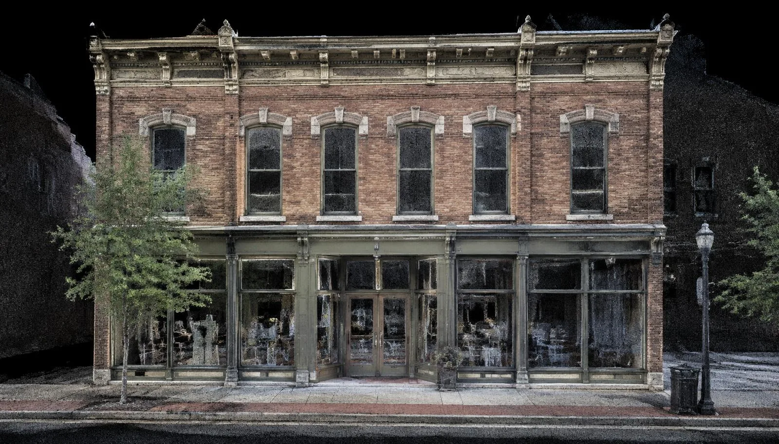
Facade and building-envelope scanning captures every exterior surface of a building as a registered point cloud, from which you can cut scaled elevations, orthographic images and an exterior model. You need it when a project changes the envelope (recladding, window replacement, historic facade restoration, an insulation or air-barrier retrofit) or when the exterior drawings on file no longer match the building. In our published pricing guide, a "Building exteriors / facades only" scope sits at $0.05–$0.09 per square foot, or $2,500–$4,500 for the guide's 50,000 sq ft example.
What does a facade scan actually deliver?
The field work produces one thing: a registered, colorized point cloud of the exterior. Everything else is extracted from it, and drawings and models are priced separately from the capture, so decide which of these you need before you ask for quotes.
| Deliverable | What it is | Who uses it |
|---|---|---|
| Registered point cloud (E57, RCP, LAS or PTS) | Every captured surface as measured 3D points, tied into one coordinate system | Architects and engineers who can work directly in the cloud |
| Orthographic images | Scaled, distortion-free views of each elevation rendered from the cloud | Restoration consultants, estimators, anyone marking up conditions |
| 2D elevations and sections (DWG) | Drafted linework: openings, floor lines, parapets, projections | Designers detailing new cladding or storefronts |
| Exterior Revit model | Walls, openings, roof and major projections modeled to an agreed LOD | Teams designing an addition or a new envelope in BIM |
| Deviation or flatness maps | Color maps showing how far a wall departs from plumb or plane | Cladding and curtain wall designers checking substrate tolerance |
Orthographic images are the most underused item here: they come straight from the cloud without drafting, and are often what a masonry or window consultant actually wants to mark up. Our as-built deliverables guide covers each format in more detail, and Scan to CAD covers drafted elevations.
Should an exterior be captured with a mobile or a tripod scanner?
Both work, and most envelope projects use both. The deciding factor is distance: how far the scanner must be from the highest surface you need, and what accuracy that distance costs.
A mobile scanner such as the NavVis VLX3 captures while the operator walks the perimeter, which makes ground-floor elevations, storefronts, courtyards and walkways fast. NavVis lists an operational range of up to 50 m, depending on processing settings, and a local accuracy of 5 mm (1 sigma) measured in a 500 m² test environment (NavVis VLX3 specifications). That is a figure for the instrument in a test room; our ±5mm is the registered point cloud for the whole building, checked against control on site.
A terrestrial tripod scanner such as the Leica RTC360 stays put and reaches farther. Leica's datasheet lists a range of 0.5 to 130 m and a 3D point accuracy of 1.9 mm at 10 m, 2.9 mm at 20 m and 5.3 mm at 40 m, at a 68% confidence level (Leica RTC360 datasheet). A tripod can see upper floors from across the street, but its accuracy falls with distance, so "millimeter accuracy" on a tall facade depends on where the setups are placed.
| Consideration | Mobile (NavVis VLX3) | Tripod (Leica RTC360) |
|---|---|---|
| Stated range | Up to 50 m operational | 0.5 to 130 m |
| Stated accuracy | 5 mm (1 sigma), local | 1.9 mm at 10 m to 5.3 mm at 40 m |
| Best exterior use | Ground-level elevations, long low-rise perimeters, courtyards | Upper floors, parapets, fabrication-critical facades |
| Main limitation | Upper stories are captured at a steep angle and lower density | Every setup takes time, and each one needs a clear line of sight |
For recladding or curtain wall work where panels will be fabricated from the scan, the mobile vs. terrestrial comparison explains why the tripod is the right tool.
How are roofs and upper elevations captured?
From the ground you cannot see a roof, and a parapet hides everything behind it. There are three ways to fill that gap:
- Scan from the roof itself. If there is a hatch or stair access and the roof can be walked safely, a scanner on the roof captures the roof surface, curbs, parapet backs and rooftop equipment, and ties them to the ground scans.
- Fly it. Drone capture covers roofs, upper facades and site context that ground scanners cannot reach efficiently. In the US, Part 107 limits a small drone to 400 feet above ground level, except that within a 400-foot radius of a structure it may fly up to 400 feet above the structure's highest point (14 CFR 107.51). The same rule requires at least 3 statute miles of flight visibility, so fog and low cloud cancel a flight day. Our drone vs. terrestrial vs. mobile LiDAR article compares the platforms.
- Get closer. A lift, an adjacent roof or an upper-floor window can put a scanner within useful range of a tall elevation on a tight urban lot.
Whichever method you use, the roof and ground data must be registered into the same coordinate system as any interior scan. A common failure on phased projects is an exterior capture tied to a different control network than the interior model.
What gets in the way of an exterior scan?
A laser scanner records only what it can see, and exteriors are full of things standing in front of the wall.
- Parked cars and trucks. A row of cars along a facade hides the base of the wall, the stoops and the storefront sills. Schedule capture when the lot or street is empty (early morning or a weekend) or ask the property manager to clear the spaces along the elevation for a few hours.
- Trees and landscaping. Foliage blocks the wall behind it and adds noise to the cloud. In Ohio, leaf-off months give a much cleaner view of a tree-lined facade, which is worth weighing against colder working conditions.
- Glass. Glazing returns little or no data, and reflections can place stray points behind the glass. Frames and mullions capture well; the glass itself shows up as a gap, which is normal.
- Scaffolding, signage and awnings. Anything temporary is captured as if it were part of the building. If scaffolding is going up for the project, scan before it arrives.
- Tight setbacks. A facade on a narrow alley can only be seen at a steep angle, which lowers point density on the upper floors.
Ask your provider to flag occluded areas in the deliverable rather than modeling through them. A clearly marked gap is more useful than a guessed wall.
Can you scan a building exterior in bad weather?
Within limits, and the limits come from both the instruments and the physics. Leica rates the RTC360 for operation from -5°C to +40°C with IP54 ingress protection (Leica RTC360 datasheet). NavVis rates the VLX3 at IP42 for 0°C to 40°C, with operation down to -10°C possible for a maximum of 20 minutes in calm conditions and with the device pre-warmed (NavVis VLX3 specifications).
Those ratings describe whether the equipment works, not whether the data is good. Rain and snow put noise into the cloud, wet surfaces return the laser differently from dry ones, and snow on ledges, sills and roofs is captured as geometry. Low sun behind the building makes the colorized imagery harder to read. For a facade scan, a dry, overcast day is close to ideal, so build a weather day into the schedule.
How is facade scanning priced?
Our cost guide publishes the band exactly:
| Scope | Typical cost per sq ft | 50,000 sq ft example |
|---|---|---|
| Building exteriors / facades only | $0.05–$0.09 | $2,500–$4,500 |
| Historic / ornate structures | $0.12–$0.20 | $6,000–$10,000 |
The first row covers exterior capture and a registered point cloud. The second applies when an entire historic or ornate structure is in scope. Before comparing quotes, confirm what area each provider's per-square-foot rate is measured against, because gross building area and facade surface area are very different numbers on a multistory building.
What moves a facade quote within the band:
- Height and access. Upper elevations that need a lift, roof access or a drone flight add field time.
- Occlusion. Heavy tree cover, parked cars or a narrow alley mean more setups.
- Survey control. Tying the scan to state plane coordinates or an existing control network often adds $1,000–$3,000 per site.
- Deliverables. Drafted elevations and models are priced separately from the capture.
- Project size. Small facade jobs usually land at a project minimum; minimum fees of $1,500–$3,500 are standard across the industry.
The scanning cost article covers the other drivers. We deliver the registered point cloud in 3 to 5 business days and return quotes within one business day.
When do you actually need a facade scan?
Recladding. New panels or curtain wall hang off an existing structure that is rarely plumb or flat. A scan shows how far each face departs from plane, so the design team can size attachment systems and shims before fabrication rather than in the field.
Window replacement. A scan measures every opening on every elevation in one visit and makes it easy to group openings into repeating types. It cannot see behind the existing frame, so use scan dimensions for design and pricing and have the supplier confirm rough openings before fabrication.
Historic facades. Ornament, stone coursing and irregular geometry are slow and risky to measure by hand. The National Park Service's Heritage Documentation Programs say they now use laser scanning on nearly every project, while still supplementing it with hand measurement, partly to draw hard lines where point cloud edges are indistinct (NPS laser scan guidance). Our historic documentation service and our article on scanning for historic preservation cover that work.
Envelope retrofits. Over-cladding with insulation, adding an air barrier or replacing a roof edge all depend on existing wall planes, parapet heights and opening positions.
If the project also touches the interior, scope both together. A single building scanning mobilization that ties the exterior and interior into one coordinate system costs less than two separate visits. Our guide to writing a scanning scope of work shows how to list the elevations, roof areas and exclusions, and you can send us the scope for a quote.
Sources
- NavVis, NavVis VLX 3 specifications: local accuracy (5 mm, 1 sigma, 500 m² test environment), operational range, operating temperature, low-temperature limits, IP42.
- Leica Geosystems, Leica RTC360 datasheet: range, 3D point accuracy by distance, 68% confidence level, operating temperature, IP54.
- Legal Information Institute, 14 CFR 107.51, Operating limitations for small unmanned aircraft: altitude limit, structure exception and minimum flight visibility.
- U.S. National Park Service, Heritage Documentation Programs, Laser Scan Guidance: use of laser scanning on HABS/HAER/HALS projects and supplementary hand measurement.