TL;DR
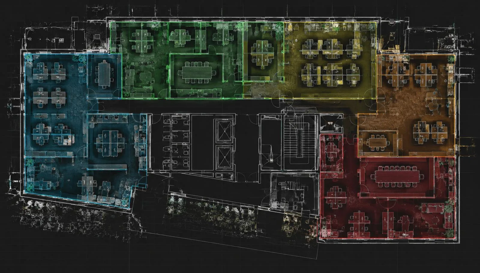
TL;DR: A laser scan before a purchase, lease or tenant improvement replaces data-room drawings with measured conditions: BOMA area calculations tied to as-built wall faces, slab-to-deck heights and above-ceiling structure. Office, retail and multifamily space scans for $0.06–$0.12 per sq ft ($3,000–$6,000 for 50,000 sq ft), with a registered point cloud in 3–5 business days after capture.
Owners, buyers, brokers and tenants scan a commercial building before a purchase, lease or tenant improvement because the drawings in the data room describe what was designed, not what was built. A laser scan replaces those assumptions with measured conditions: floor areas you can defend in a lease, a record of what sits above the ceiling, and the slab-to-deck heights a TI design depends on. For an office, retail or multifamily building, our published pricing puts capture and a registered point cloud at $0.06–$0.12 per square foot, or $3,000–$6,000 for a 50,000 sq ft building, which is small next to the rent, price or construction budget that the measurements feed.
Why do buyers, tenants and brokers scan before a deal closes?
Each party is trying to answer a different question, and the deliverable should match the question rather than default to "a full model."
| Who | The question they need answered | Deliverable that answers it |
|---|---|---|
| Buyer or acquisitions team | Is the rentable area on the rent roll supported by the building, and what is hiding above the ceilings? | Registered point cloud, floor plans, BOMA area calculations |
| Owner or landlord | Are the lease exhibits and area figures still right after years of tenant turnover? | Floor plans and BOMA area calculations tied to measured wall faces |
| Tenant or tenant rep broker | Does the premises match the lease exhibit, and will our layout actually fit? | Floor plans with verified dimensions and ceiling heights |
| Architect or contractor on the TI | What are the real heights, column sizes and above-ceiling conditions we are designing around? | Point cloud plus a Revit model at LOD 200 or 300 |
The useful part is that one field capture can serve all four. The point cloud is the master record; floor plans, area calculations and models are extracted from it when someone needs them, so a buyer who scans during diligence already has the base data the leasing team and the TI architect will ask for later.
What does a property condition assessment leave out?
A property condition assessment is the standard physical diligence document, and it is not a measured survey. ASTM E2018-24, the standard guide for baseline property condition assessments, describes a walk-through survey supported by document review, research and interviews, with the result delivered as a property condition report. The same guide states that the PCA is "not intended to be construed as technically exhaustive" and recognizes that a suggested remedy may be formed without the aid of engineering calculations, testing, exploratory probing, or the removal or relocation of materials. Measuring or verifying building areas and dimensions is not part of its described scope.
The PCA is doing a different job. The condition report tells you what is deficient; a laser scan tells you where everything is and how big it is. The two work well together: the PCA flags a roof or MEP concern, and the scan gives the design team the geometry to scope the repair.
Be clear about the limits of a scan too. It records surfaces the scanner can see. It does not see inside walls or under slabs, it is not a boundary survey, and it does not replace environmental or structural engineering reviews. Above-ceiling conditions are captured only where tiles are lifted or the plenum is open.
How does a scan verify rentable and usable area?
Commercial area in the US is commonly measured to a BOMA standard, and there is a separate standard for each property type. BOMA International currently lists, among others, BOMA 2024 for Office Buildings (ANSI/BOMA Z65.1-2024), BOMA 2025 for Industrial Buildings (ANSI/BOMA Z65.2-2025), BOMA 2025 for Retail Properties (ANSI/BOMA Z65.5-2025) and BOMA 2023 for Multi-Family and Hospitality Properties (ANSI/BOMA Z65.4-2023). BOMA states that the primary purpose of the office standard is to calculate Rentable Area, which it calls a crucial metric in office leasing.
Two practical points follow for anyone in a deal:
- The lease decides which standard applies. Office rent is often tied to area through a load factor, which Otten Johnson describes as a ratio that accounts for common amenity and service areas and that landlords apply to a tenant's private office area. The same article advises landlords and tenants to check which measurement standard, if any, governs their existing leases.
- Editions change the answer. A BOMA/Chicago article on the 2017 office standard notes that it increased the opportunity to capture Rentable Area, such as balconies and finished rooftop terraces, and suggests that anyone preparing to buy or sell a property may benefit from an updated measurement.
Where the scan comes in is the measurement underneath the method. ZEALOT drafts floor plans from a registered point cloud at ±5mm registered accuracy, and the BOMA area calculations are produced from that same cloud, so the boundaries are tied to as-built wall faces rather than to a drawing set that may not match what was built. The standard and measurement basis are stated on the drawing, which is what makes the numbers usable as lease exhibits and in remeasurement discussions. We report the measured result; we do not tell you whether the old figure was "right" for your lease, which is a question for the parties and their advisors.
Why don't the as-built drawings match the building?
Because very few buildings have a complete record of every change since construction. Drawings capture design intent at a point in time. After that, demising walls move with each tenant, shafts get added, ceilings drop, columns get furred out, and partial renovations are drawn by different firms to different standards, or not drawn at all. By the time a building is on the market, the "as-builts" in the data room are often several generations of partial updates.
The cost of trusting those drawings shows up later, in someone else's budget: a column larger than drawn, a ceiling that will not clear new ductwork, or a rent roll built on areas nobody measured. We go through how those errors compound on AEC projects in The True Cost of Bad As-Builts.
What does a tenant improvement design need that a floor plan doesn't show?
A floor plan answers "where are the walls." A TI design needs the third dimension and everything above the ceiling grid. A commercial fit-out scan is scoped to capture:
- Slab-to-deck and slab-to-slab heights throughout the space
- Structure above the ceiling, including beams, ductwork, sprinkler mains and conduit routing
- Existing MEP mains and branch routing, and clearance zones for new equipment or ceiling systems
- Column locations and true dimensions, which often differ from the drawing set
- Curtain wall and mullion positions that govern where new partitions can land
- Core walls, shafts and existing demising walls between tenant spaces
- Floor flatness and levelness where finish work depends on it
- Base-building conditions compared with the landlord's drawings
The last item matters in lease negotiations as much as in design: a base-building condition that differs from the landlord's drawings is better raised before the work letter is signed than after the contractor finds it.
Above-ceiling capture is the part that moves the budget. Lifting tiles and scanning the plenum can add 20–50% to a project, according to our pricing guide, so scope it to the areas where the design will actually route new systems.
How long does it take, and will it disrupt the tenants?
Mobile LiDAR capture covers 80,000–120,000 sq ft per field day, so most single-building diligence scans need one or two days on site. Occupied spaces are captured after hours or overnight so tenants keep working. The processing clock is separate from the field clock:
| Stage | Published turnaround |
|---|---|
| Quote | Within one business day |
| Field capture | 80,000–120,000 sq ft per field day |
| Registered point cloud | 3–5 business days after capture |
| LOD 200 Revit model | 10–15 business days for roughly 100,000 sq ft |
| LOD 300 Revit model | 3–5 weeks, with model faces held to ±10mm |
For a purchase, the practical advice is to order the scan early in the diligence period so the point cloud arrives while there is still time to act on what it shows. For a TI, a registered point cloud is often enough to start test fits while the Revit model is produced. Our article on how long laser scanning takes covers the two clocks in more detail.
What does scanning a commercial building cost?
The published band is $0.05–$0.20 per square foot for field capture and a registered point cloud. Office, retail and multifamily space sits at $0.06–$0.12, which is $3,000–$6,000 for a 50,000 sq ft example. Floor plans, Revit models and BOMA area calculations are priced separately on top, based on the deliverable and LOD, and above-ceiling access, occupancy and after-hours scheduling move a project within the band.
Compare that with what rides on the measurements: the rent calculated from rentable area, the price negotiated from it, and a TI budget that depends on undocumented heights and above-ceiling conditions. The 3D laser scanning cost guide has the per-building-type table and sample budgets.
Which deliverables should you ask for at each stage?
Buy the capture once and extract deliverables as the deal moves forward.
| Stage | Start with | Add when |
|---|---|---|
| Pre-purchase diligence | Registered point cloud and panoramic imagery | Floor plans and BOMA calculations when the rent roll depends on area figures |
| Lease negotiation or remeasurement | Floor plans and BOMA area calculations | Reflected ceiling plans when ceiling heights are part of the deal |
| TI design | Point cloud plus a Revit model at LOD 200 | LOD 300 where new MEP must coordinate with existing structure |
| After the build-out | Updated as-built documentation | A property-wide record set when the owner wants one archive for every future lease |
For buildings changing use rather than changing tenants, the Adaptive Reuse Due-Diligence Guide walks through the same logic applied to conversions.
What should you put in the request for quote?
A scanning quote comes back accurate when the request answers these questions:
- Property type and approximate area, including which floors, suites and exterior areas are in scope.
- The measurement standard and edition the lease or purchase agreement references, if area calculations are needed.
- Occupancy and access windows: occupied or vacant, business hours or after hours, escort or badging requirements.
- Above-ceiling scope: which areas need tiles lifted and plenum capture.
- Deliverables and LOD: point cloud only, floor plans, BOMA calculations, Revit model, and at what level of development.
- Deadlines: the diligence or lease date the data has to support.
Send those to our team and we will return a scoped quote within one business day.
Sources
- ASTM International, ASTM E2018-24 Standard Guide for Property Condition Assessments: Baseline Property Condition Assessment Process
- BOMA International, BOMA Standards
- Otten Johnson Robinson Neff + Ragonetti, BOMA 2017 Office Standard: What You Need to Know
- BOMA/Chicago, How BOMA 2017 Can Change Your Building's Rentable Square Footage (RSF)