Professional Building Scanning for Structural Analysis
Engineers receive a dimensionally accurate point cloud and Revit model, enabling reliable structural analysis, capacity calculations, and clash-free retrofit design.
TL;DR: Building scanning gives engineers a precise 3D digital replica of a structure's true as-is condition. It captures member sizes, locations, and deflections that old drawings miss or misrepresent. This accurate data provides a reliable foundation for structural analysis, finite element modeling (FEM), and retrofit design, minimizing risks associated with unknown conditions.
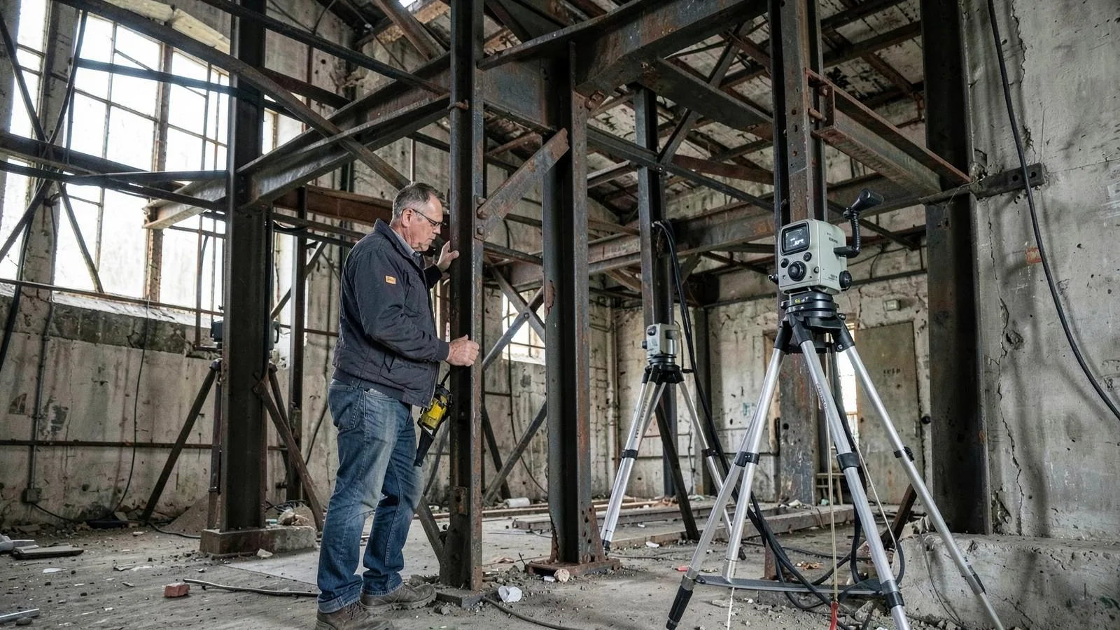
Building Scanning for Structural Analysis, explained simply
Building scanning uses 3D laser scanners to capture millions of measurement points on a structure's surface, creating a complete digital copy called a point cloud. This process reveals the exact geometry of beams, columns, and connections, including any sag, twist, or deformation that has occurred over time. Engineers use this dimensionally accurate data to create a reliable as-built BIM model in Revit. This model becomes the basis for accurate structural analysis, load calculations, and planning for renovations or additions, preventing costly surprises and rework during construction.
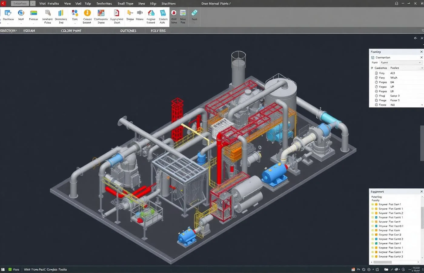
±5mm accuracy, NavVis VLX3 mobile LiDAR
Real impact on AEC project outcomes
Eliminate unknowns from outdated or inaccurate drawings
Reduce design rework from unforeseen field conditions
Improve the accuracy of structural simulations and load calculations
Increase safety by reducing manual measurements at height
Accelerate the design phase for retrofits and additions
Create a permanent, verifiable record of as-is conditions
From kickoff to delivery in 5 clear steps
Consultation & Scoping
The team defines the project scope, required Level of Development (LOD), and specific deliverables for the structural analysis. A detailed proposal is delivered within 24 hours.
On-Site Building Scanning
A specialized field crew mobilizes to the site to execute the 3D building scanning. The non-disruptive process typically takes 1-3 days, capturing all accessible structural components.
Point Cloud Registration
Scan data is processed, cleaned, and registered into a unified, accurate point cloud. This deliverable is typically ready in 3-5 business days.
Structural Modeling & QA
The team develops a Revit structural model from the registered point cloud to the specified LOD, ensuring model faces are within ±10 mm of the scan data at LOD 300.
Deliverable Hand-Off
The client receives all final files, including the registered point cloud, Revit model, and any requested 2D drawings or analysis reports, for immediate use in their workflow.
Built for teams that can't afford guesswork
- Structural Engineers
- Architects
- General Contractors
- Building Owners
- BIM/VDC Managers
Stop losing time and money to bad data
- ✗Inaccurate or missing as-built drawings
- ✗Unknown structural member sizes and geometry
- ✗Unquantified beam and floor deflections
- ✗Risk of clashes between new and existing structures
- ✗Time-consuming and hazardous manual field measurements
- ✗Difficulty verifying load paths in complex buildings
Specific deliverables, in formats your team already uses

Verifying Structural Capacity for a Mezzanine Retrofit
An engineering firm planned a new mezzanine within an active warehouse but lacked reliable drawings for the existing steel frame. ZEALOT performed comprehensive building scanning to capture the entire structural system, including all columns, beams, and bracing.
The resulting point cloud and Revit model provided precise measurements of all structural members, revealing existing deflections. This enabled the engineers to accurately analyze the structure's load capacity and design the new mezzanine for a clash-free fit, ensuring safety and project continuity.
Building Scanning for Structural Analysis FAQ
Common questions about our building scanning services
Complete Guide to Building Scanning for Structural Analysis
## Why is Building Scanning Crucial for Structural Retrofits? Structural retrofits and renovations depend on understanding the existing building frame. Relying on outdated or incomplete as-built drawings introduces significant risk into the project. These documents often fail to account for previous modifications, construction deviations, or the long-term effects of loading and settlement. This information gap can lead to incorrect analysis, flawed design, and costly change orders during construction. Building scanning replaces assumptions with verifiable data. It provides a complete and accurate 3D snapshot of the structure as it stands today. This allows engineers to base their analysis and design on reality, not on potentially flawed historical records. A precise digital foundation is the first step in a successful [structural Scan-to-BIM](/services/structural-scan-to-bim) project and mitigates the [risks of inaccurate documentation](/blog/design-risks-inaccurate-as-built-documentation).
## What Structural Details Can Laser Scanning Capture? 3D laser scanning captures a comprehensive set of data about a building's structural system. The resulting high-density point cloud documents the precise size, shape, and location of primary and secondary structural members, including columns, beams, joists, trusses, and bracing. It records floor and roof deck geometry, capturing any sagging or unevenness with high fidelity. Beyond basic geometry, the data allows for detailed analysis of member conditions. It is possible to measure beam deflection, column plumbness, and the geometry of structural connections. For concrete structures, the scan can document slab edges, column capitals, and major openings. This level of detail supports robust [existing structure verification](/services/existing-structure-verification) and provides engineers with the confidence to make critical design decisions.
## How Does Scan Data Integrate with Engineering Workflows? The primary deliverable for structural analysis is typically an intelligent 3D model created from the point cloud data. ZEALOT develops structural models in Autodesk Revit, which can be exported to various file formats like IFC (Industry Foundation Classes) for broad compatibility. This allows engineers to import the as-built model directly into their preferred structural analysis software, such as RISA, ETABS, or SAP2000. By starting with an accurate model, engineers can perform more reliable finite element analysis (FEA), load calculations, and seismic assessments. The model also serves as the base for designing new elements in the same software environment, enabling clash detection between the existing structure and proposed additions. This streamlined process connects reality capture directly to the [Scan-to-BIM renovation](/services/revit-scan-to-bim-renovation) workflow, reducing manual data entry and potential for error.
## What is the Accuracy of Building Scanning for Analysis? Accuracy is paramount in structural analysis. ZEALOT's building scanning process achieves a registered field accuracy of ±5 mm. This is accomplished by using professional-grade terrestrial laser scanners and a network of survey targets to register individual scans into a single, cohesive coordinate system. The resulting point cloud is a globally accurate digital twin of the physical structure. When modeling from this point cloud, the team adheres to strict tolerances. At a typical LOD 300, modeled structural faces are accurate to within ±10 mm of the registered point cloud. This level of precision is essential for engineers who need to understand true member sizes and locations for their calculations. For a deeper look at how these tolerances impact engineering decisions, explore this guide on [Scan-to-BIM tolerance analysis for engineers](/blog/scan-to-bim-tolerance-analysis-engineers).