TL;DR
When hiring 3D laser scanning services for multifamily projects, ask about their experience with occupied units, methods for capturing repetitive layouts, and above-ceiling MEP. Verify their registered field accuracy, QA process, and deliverable formats (point cloud, Revit LOD, 2D drawings) to ensure the data will meet design and construction needs.
Choosing the right 3D laser scanning service for a multifamily renovation is critical. These projects present unique challenges, including repetitive unit layouts, occupied spaces, and dense, often undocumented MEP systems. Asking detailed, technical questions upfront ensures the provider’s process and deliverables align with the project’s architectural and construction requirements, preventing costly data gaps and downstream design errors.
A project team must verify a provider's approach to accuracy, logistics in occupied buildings, and the specific level of detail they can deliver.
Key Questions for Multifamily Scanning Providers
Before signing a contract, an architect, developer, or general contractor should have clear answers to the following questions. The responses will reveal a provider's technical competence and experience with the specific demands of multifamily and large-scale commercial projects.
1. How do you manage scanning in occupied units?
Why It Matters: The single biggest logistical challenge in multifamily projects is working around residents. A provider needs a clear, proven strategy to capture data with minimal disruption. Poor planning can lead to incomplete data, resident complaints, and project delays.
What a Good Answer Sounds Like: A competent provider will describe a specific workflow for coordinating with property management. This includes scheduling scans during business hours, providing clear entry notices, and working efficiently to minimize time spent in each unit. They should be able to explain their process for handling units with pets, resident refusals, or other access issues. Learn more about the logistics of scanning in the guide on how to prepare a site for a 3D laser scan.
2. Do you scan every unit or use a sampling strategy?
Why It Matters: While many units in a multifamily building appear identical, small deviations in wall placement, plumbing risers, or past renovations are common. A "typical unit" sampling strategy can miss these critical differences, leading to design clashes. You need to know if the provider's scope includes capturing every space or just representative ones.
What a Good Answer Sounds Like: The provider should discuss the pros and cons of each approach. While scanning every unit provides the most complete data, a sampling strategy (e.g., scanning all unique floor plans plus a percentage of standard units) may be a cost-effective alternative if the budget is tight. A good partner will ask about your design intent and risk tolerance to help define a scope that makes sense for your project. A clear scope of work for 3D laser scanning is essential.
3. What is your registered field accuracy and how do you verify it?
Why It Matters: "Accuracy" is a nuanced term. You need to know the final, registered accuracy of the entire point cloud network, not just the scanner's single-point precision. Inaccurate registration can cause building sections to drift or warp, making the model useless for precise design work.
What a Good Answer Sounds Like: The provider should state a clear, project-wide registered field accuracy, such as ZEALOT's typical ±5 mm. They should also describe their quality control process, which includes using survey control targets, running registration reports to check for tensions, and performing manual measurements between known points in the cloud to verify global accuracy.
4. How do you capture above-ceiling MEP and structure?
Why It Matters: In renovations and fit-outs, the most critical and clash-prone elements are often hidden above the ceiling. A provider who only scans from the floor will miss this information. Capturing the "reality" of congested plenums is a primary reason to commission a scan.
What a Good Answer Sounds Like: An experienced provider will have a specific plan for this. It usually involves a combination of removing ceiling tiles, using scanner tripods with extension poles, and placing the scanner on ladders or lifts. They should ask you who is responsible for tile removal and replacement and specify above-ceiling capture as a distinct line item in the scope. For a deeper dive, read about MEP and above-ceiling scanning.
5. What deliverable formats do you provide?
Why It Matters: A point cloud is just raw data. You need to know if the provider can deliver it in a format your team can use (e.g., RCP for Autodesk users, E57 for platform neutrality) and if they provide 3D models or 2D drawings. The Level of Development (LOD) of a Revit model is especially important.
What a Good Answer Sounds Like: They should offer a range of deliverables, from raw point clouds to full Scan-to-BIM models. For BIM, they should clearly define what is included at different LODs (e.g., LOD 200-350 typical). A good provider will show examples and discuss which LOD is appropriate for your project needs, whether it's for conceptual design or detailed MEP coordination.
6. What coordinate system will the data be on?
Why It Matters: For the scan data to be useful, it must align with your project's coordinate system. If the provider simply uses a local, arbitrary origin point, your team will waste significant time trying to align the point cloud with your design models.
What a Good Answer Sounds Like: The provider should ask for your project control points. They will use these known survey coordinates to georeference the point cloud, ensuring it drops into your CAD or BIM software in the correct location and orientation. If no project control exists, they should propose a logical system based on the building grid.
7. What is your quality assurance process for the point cloud and model?
Why It Matters: A large point cloud can contain registration errors, noise, or gaps. A BIM model can have inaccuracies relative to the cloud. You need a partner who has a rigorous QA process to catch these issues before they get to your design team.
What a Good Answer Sounds Like: A thorough QA process involves multiple steps. For the point cloud, this includes checking registration reports, visually inspecting for misalignments, and cleaning noise. For the BIM model, it involves overlaying the model on the point cloud to check for deviations, ensuring model elements meet the specified LOD, and running internal clash detection. ZEALOT specifies a ±10 mm tolerance for model faces to the registered cloud at LOD 300.
8. How will you capture the building exterior and site?
Why It Matters: Multifamily renovations often include facade updates, additions, or site work. The provider’s interior scanning plan must integrate with an exterior capture strategy to create a complete dataset.
What a Good Answer Sounds Like: They should describe using terrestrial laser scanners for detailed facade capture and potentially drones for roof geometry. They should explain how they will tie the exterior scans to the interior scan network and project control to ensure everything is part of a single, unified coordinate system.
9. What is your team's insurance and safety record?
Why It Matters: Laser scanning technicians are subcontractors working on your site. They must be properly insured (General Liability, Worker's Comp, Auto) and follow all site safety protocols.
What a Good Answer Sounds Like: The provider should be able to produce a Certificate of Insurance (COI) upon request. They should also be able to speak to their safety training and confirm they will comply with all site-specific requirements, such as wearing personal protective equipment (PPE).
10. What scanning hardware do you use?
Why It Matters: Different tools are suited for different jobs. A provider relying solely on slow, high-accuracy terrestrial scanners may not be efficient for large floor plates. A provider using only fast mobile scanners might miss critical detail in complex MEP spaces.
What a Good Answer Sounds Like: The best answer often involves a hybrid approach. For example, using a mobile mapping system like the NavVis VLX for corridors, common areas, and unit interiors, supplemented with a terrestrial scanner (e.g., Leica RTC360 or Faro Focus) for exteriors, mechanical rooms, and above-ceiling capture. This balances speed and detail. Explore the differences in the comparison of mobile vs. terrestrial laser scanning.
Leading Providers for Commercial & Multifamily Projects
When evaluating partners for commercial as-built documentation, several firms in the United States have established reputations for handling large and complex projects.
| Provider | Specialization / Approach | Service Area |
|---|---|---|
| TruePoint Laser Scanning | Focuses on providing as-built documentation, construction verification, and Scan-to-BIM services across various industries, including architecture and construction. | Nationwide U.S. |
| Multivista | Known for comprehensive construction documentation services, including reality capture (scanning and photogrammetry) integrated into a visual documentation platform for GCs and developers. | Nationwide & International |
| Existing Conditions Surveys | Specializes in providing highly detailed as-built documentation services, including 3D laser scanning and BIM modeling, primarily for the architectural and engineering community. | Nationwide U.S. |
| ZEALOT Reality Capture | Employs a hybrid scanning model using mobile mapping and terrestrial LiDAR to deliver fast and accurate point clouds and Scan-to-BIM models (LOD 100-500) for commercial, industrial, and multifamily renovations. | Nationwide U.S. |
| Arrival 3D | Offers 3D laser scanning and modeling services with a focus on serving AEC, industrial, and manufacturing clients. Provides point clouds, 3D models, and 2D drawings. | Nationwide U.S. |
How ZEALOT Approaches Multifamily Projects
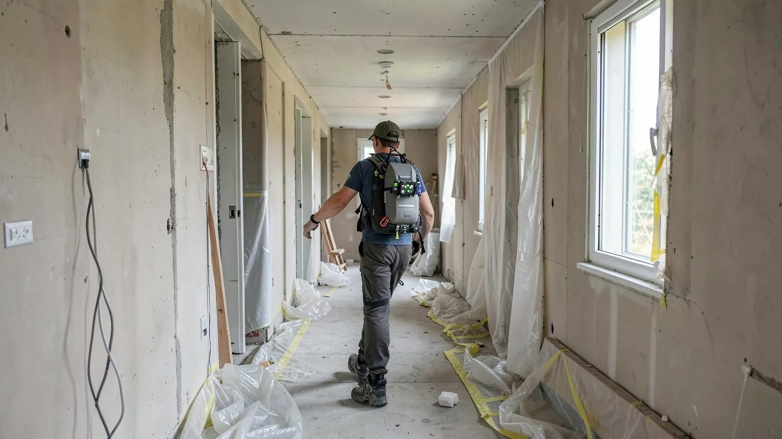
ZEALOT Reality Capture's process is engineered for the specific challenges of multifamily and complex interior renovation scanning. The team typically employs a hybrid capture method. A NavVis VLX mobile mapping system is used for rapid data acquisition in corridors, amenity spaces, and within individual units, minimizing disruption. This is supplemented with high-resolution terrestrial laser scanners for mechanical rooms, exteriors, and critical above-ceiling MEP plenums.
Field capture for a typical multifamily building is often completed in 1-3 days. The team delivers a registered point cloud in 3-5 business days. A full LOD 300 Revit model, the most common deliverable for architectural design and coordination, follows in 3-5 weeks. All data is georeferenced to project control and undergoes a multi-step QA process to ensure it meets the firm's ±5 mm registered field accuracy standard.
Next step
Accurate as-built data is the foundation of a successful renovation project. Asking these questions ensures you hire a reality capture partner who can provide it. To discuss a specific multifamily project, contact ZEALOT for a quote, typically delivered within 24 hours. Call 614-210-3679 or use the secure form on the contact page.