TL;DR
Choosing the right 3D laser scanning service depends on your specific project type. For large industrial facilities, prioritize providers who use a mix of mobile and terrestrial scanning for both speed and precision around complex equipment. Complex interior fit-outs demand high-accuracy scanning to capture dense MEP, while multi-site portfolios benefit from firms capable of standardized, rapid capture across locations. Historic preservation projects require specialists skilled in capturing intricate details without damaging fragile materials. Key evaluation criteria change with the project, including capture method, accuracy tolerance, required level of development (LOD), deliverables, and the provider's ability to navigate site-specific challenges. Understanding these nuances is critical to selecting a partner who can deliver actionable as-built documentation.
Best US 3D Laser Scanning Services for As-Builts
TL;DR
- Industrial projects need providers skilled in hybrid scanning (mobile + terrestrial) and navigating operational sites.
- Interior fit-outs require high-resolution terrestrial scanning to capture dense above-ceiling MEP accurately.
- Commercial as-builts prioritize speed and cost-effectiveness, making mobile scanning ideal for large floors.
- Infrastructure scanning demands expertise in survey control and long-range scanners for accuracy over distance.
- Historic preservation scanning requires specialists who can capture intricate detail without damaging fragile structures.
Jump to: How do you choose a provider for industrial facility scanning? · What defines a good service for complex interior fit-outs? · What matters most for commercial construction as-builts? · What are the key criteria for infrastructure and bridge scanning? · How do you evaluate services for historic and adaptive reuse projects? · What should you look for when scanning a multi-site portfolio? · What are the different types of 3D scanning providers? · Where to go next
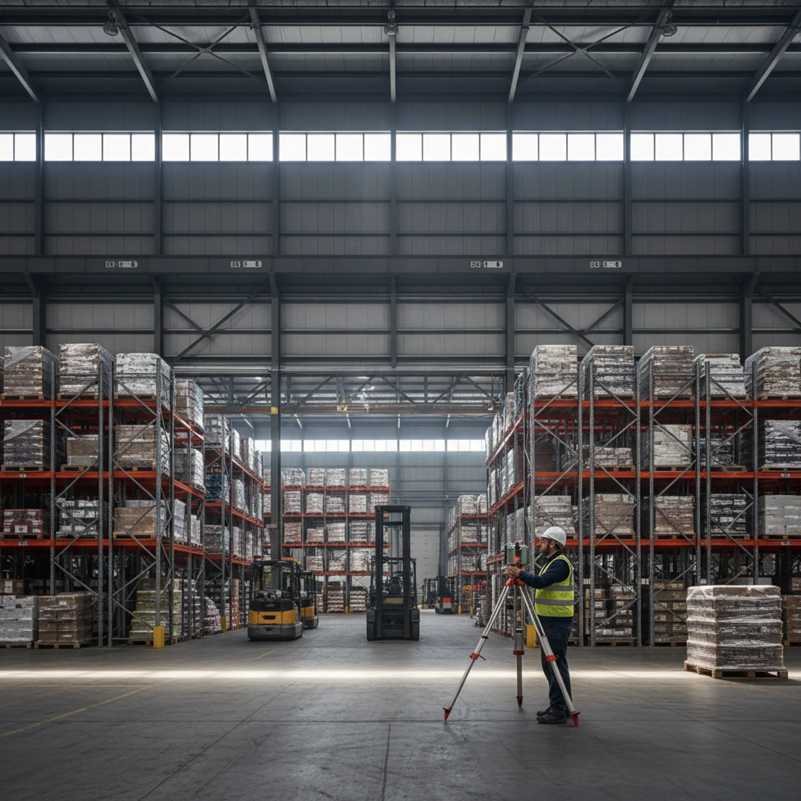
Choosing among the many US-based 3D laser scanning services requires more than a simple price comparison. The best provider for one project may be a poor fit for another. The optimal choice depends entirely on the unique demands of your project type, from the complexity of an industrial plant to the scale of a multi-site retail portfolio.
This guide provides a framework for architects, general contractors, and facility owners to make that decision. Instead of offering generic advice, it breaks down the specific evaluation criteria for six common project types. Use this information to vet potential providers and ensure the partner you select has the right equipment, expertise, and deliverables to support your project's success. For a more general overview, a companion article details how to evaluate 3D laser scanning services in the United States.
How do you choose a provider for industrial facility scanning?
For industrial projects—such as manufacturing plants, processing facilities, or distribution centers—the primary challenges are scale, equipment density, and operational constraints.
- Capture Method Fit: A provider must use a hybrid scanning approach. For large, open floor areas and warehouse aisles, mobile LiDAR systems like the NavVis VLX3 capture data at walking pace, drastically reducing time on-site. For areas with dense, complex equipment, piping, and structural steel, tripod-mounted terrestrial scanners are necessary to achieve the high level of detail and minimize occlusions (data shadows). A provider relying on only one method will either be too slow or will fail to capture critical components with sufficient accuracy.
- Accuracy and Deliverables: The standard for industrial retrofits is a registered point cloud with an accuracy of ±5mm. This precision is essential for clash detection and prefabrication. The primary deliverable is often an LOD 300 to LOD 350 Revit model that accurately represents MEP systems, structural elements, and major equipment. Ask potential providers for examples of their industrial 3D laser scanning work to verify their modeling quality.
- Site-Access Handling: Industrial sites are often active and may contain hazardous areas. A competent provider will have a robust safety program (e.g., OSHA certifications) and experience working around operational machinery. They should be able to articulate a clear plan for phasing the scan to minimize disruption to your facility’s production schedule.
What defines a good service for complex interior fit-outs?
For interior fit-outs and renovations in spaces like hospitals, labs, or dense office environments, the most critical existing conditions are often hidden above the ceiling.
- Capture Method Fit: Mobile scanning is generally not suitable for capturing congested plenums. The best providers for this work rely exclusively on high-resolution terrestrial laser scanners set up on tripods. This method allows the scanner to be elevated and positioned strategically to capture the intricate network of ducts, conduits, pipes, and fire suppression lines above the ceiling grid. The ability to execute a comprehensive above-ceiling scanning plan is a key differentiator.
- Level of Detail (LOD) and Accuracy: The goal is to avoid design conflicts and costly rework. This requires a highly accurate and detailed as-built model. The deliverable should be an LOD 300–350 Revit model where all MEP components larger than a specified diameter (e.g., 1 inch) are modeled true-to-location. The accuracy of the point cloud data underpins this, ensuring that MEP design decisions are based on reliable information.
- Turnaround and Modeling Expertise: While terrestrial scanning takes longer on-site than mobile mapping, the value is in the data quality. A good firm will have an efficient modeling team that can turn the dense point cloud into a usable BIM model quickly. Ask about their point cloud registration process and quality control checks, as poor point clouds disrupt BIM coordination and negate the benefits of scanning.
What matters most for commercial construction as-builts?
For typical commercial buildings—offices, retail spaces, and mixed-use developments—the key drivers are often speed, budget, and creating foundational documentation for space planning or renovation.
- Capture Method Fit: This is the ideal use case for mobile LiDAR. A provider equipped with a system like the NavVis VLX3 can scan large facilities, such as an 80,000–120,000 sq ft office building, in a fraction of the time it would take with terrestrial scanners. This speed translates directly to lower costs and faster deliverable turnaround.
- Cost and Deliverable Flexibility: Because the needs for commercial as-builts can vary, a provider should offer a flexible menu of deliverables. This could range from a raw registered point cloud for archival purposes, to simple 2D as-built floor plans, to a basic LOD 200 Revit model showing walls, floors, ceilings, and columns. Scan to BIM pricing for these projects typically falls in the $0.05–$0.20 per square foot range, depending on complexity and the required LOD.
- Site-Access Handling: Commercial buildings are often occupied. The ability to scan with minimal disruption to tenants is crucial. Mobile scanning is relatively unobtrusive compared to the constant setup and teardown of tripods. A professional provider can schedule work after hours or phase it to accommodate an active environment, an important consideration when you need to scan an occupied building.
What are the key criteria for infrastructure and bridge scanning?
Scanning infrastructure like bridges, tunnels, and roadways introduces challenges of scale, distance, and the need for survey-grade accuracy.
- Capture Method and Survey Control: Long-range terrestrial laser scanners are required for this work. These instruments can capture data from hundreds of meters away, necessary for large structures like bridges. Critically, the provider must be proficient in establishing a survey control network across the entire project site. Without proper control, individual scans will not align correctly, rendering the final point cloud inaccurate for engineering analysis.
- Accuracy and Standards: The required accuracy is often higher and must be verifiable against an established coordinate system. Providers should be able to discuss their process for meeting standards like the USIBD Level of Accuracy (LOA) or ASTM E3125-17. The deliverables are often not BIM models but highly accurate point clouds for deformation analysis or 2D CAD drawings for structural assessments.
- Specialized Expertise: This is a niche application of 3D laser scanning services. A qualified firm will have a portfolio of civil/infrastructure projects and staff with a background in land surveying. They should be able to discuss specific challenges like capturing data over water, dealing with traffic control, and integrating scan data with traditional survey data.
How do you evaluate services for historic and adaptive reuse projects?
Historic preservation and adaptive reuse projects involve unique, often fragile, and geometrically irregular structures. The provider must be a specialist in this type of documentation.
- Capture Method Fit: The primary concern is capturing detail without touching or damaging delicate surfaces. Terrestrial laser scanning is the standard non-contact method. The high resolution captures ornate details, façade ornamentation, and structural deviations with precision. The provider’s experience is paramount; they must know how to plan scan locations to document complex geometry thoroughly, a key aspect of 3D scanning for historic preservation.
- Deliverable Set: Deliverables serve two masters: the preservationist and the architect. A high-resolution point cloud with color imagery (from the scanner's integrated camera) serves as a permanent historical record. For adaptive reuse, a detailed Scan to BIM model is essential. This model must accurately capture the non-plumb walls, sloped floors, and irregular openings that define old buildings, preventing design errors down the line.
- Modeling Approach: Modeling historic buildings requires a different skillset than modeling modern construction. The team must be able to model non-standard components and represent existing conditions as they are, rather than forcing them into idealized, orthogonal shapes. Ask for a portfolio of historic projects and scrutinize the quality of the as-built models.
What should you look for when scanning a multi-site portfolio?
For facility managers or corporations managing a portfolio of dozens or hundreds of buildings, the goal of a scanning initiative is to create a standardized, reliable dataset across all properties.
- Consistency and Scalability: The single most important criterion is the provider's ability to execute a standardized workflow at scale. They must use the same capture specifications, registration process, and modeling standards for every site. This ensures that the as-built documentation for a building in Ohio is directly comparable to one in Texas. Ask about their quality control program and how they ensure consistency across teams and projects.
- Rapid, Low-Disruption Capture: Mobile scanning is a necessity for portfolio-level projects. The ability to quickly capture facilities nationwide is a key logistical advantage. The provider should have the operational capacity to deploy teams to multiple locations simultaneously or in rapid succession.
- Data Management and Access: A portfolio project generates a massive amount of data. A top-tier provider will offer a centralized cloud platform for hosting the point cloud panoramas and deliverables. This gives stakeholders immediate, browser-based access to the virtual site from anywhere, eliminating the need for redundant site visits and facilitating remote collaboration. This transforms the deliverable from a static file into a dynamic facility management documentation tool.
What are the different types of 3D scanning providers?
Understanding the business models of different 3D scanning firms helps in selecting the right one. Your choice of partner is as important as your choice of technology, a topic covered in more detail in a dedicated 3D laser scanning provider buyer's checklist.
| Provider Category | Strengths | Weaknesses | Best-Fit Project Type |
|---|---|---|---|
| National Survey Firms | Broad geographic coverage; integrated survey services; established reputation. | Reality capture may be a small part of a larger service offering; less specialized expertise; may have higher overhead. | Infrastructure, large civil projects, projects requiring state-plane coordinate systems. |
| Regional Reality-Capture Specialists | Deep, focused expertise in scanning and BIM; agile and responsive; often technology leaders. | Geographic reach may be limited (though many, like ZEALOT, serve clients nationwide); smaller team size. | Complex industrial, MEP-heavy renovations, historic preservation, commercial as-builts. |
| Offshore Modeling Shops | Low cost for modeling labor. | No scanning capability (data must be provided); potential communication barriers; quality control can be a major issue. | Very large, simple modeling tasks where a client has in-house scanning and a strong QA team. |
| DIY (Buy a Scanner) | Full control over schedule; asset ownership. | High capital expense for hardware and software; steep learning curve; requires dedicated staff for capture, processing, and modeling. | Firms with a high, continuous volume of simple, repeatable scanning needs. |
Where to go next
Selecting the best 3D laser scanning service is about matching a provider's specific capabilities to your project's unique requirements. By using this project-based framework, you can ask more targeted questions and better vet potential partners. For a deeper dive into specifying your needs, review how to write a clear 3D laser scanning scope of work. To see examples of completed projects across these categories, explore a portfolio of work.