TL;DR
Building scanning significantly enhances safety during renovation inspections by capturing complete structural data from a distance. This minimizes the time engineers and inspectors must spend in hazardous areas, on lifts, or in confined spaces, reducing physical risk while providing more accurate data for analysis.
Building scanning improves the safety of renovation inspections by enabling engineers to collect comprehensive structural data from a distance. A 3D laser scanner captures millions of precise measurement points from a safe, stable position on the ground, drastically reducing the time personnel must spend on ladders, in aerial lifts, or inside potentially compromised structures. This remote data capture minimizes physical risk exposure while delivering a more complete and accurate dataset for structural assessment than manual methods can provide.
The resulting point cloud acts as a precise digital copy of the existing conditions, allowing engineers to perform detailed analyses back in the office, away from site hazards.
The Inspection Problem in Renovations
Traditional structural inspections on renovation projects often require engineers and technicians to work in high-risk environments. Documenting an existing building's geometry and condition involves direct physical access, which introduces several common safety challenges.
Common On-Site Hazards
- Work at Height: Measuring ceiling joists, roof trusses, or high-bay structural steel requires using ladders, scaffolding, or aerial lifts, all of which carry an inherent risk of falls.
- Confined Spaces: Accessing crawl spaces, service tunnels, or tight mechanical plenums for inspection exposes personnel to poor air quality, entrapment risks, and ergonomic injuries.
- Unstable Structures: In buildings with known or suspected damage from fire, water, or long-term neglect, the very act of inspection can be dangerous. Walking on compromised floors or near deteriorating walls puts inspectors at direct risk.
- Occupied Buildings: Working around building occupants and ongoing operations creates logistical hurdles and potential hazards. Cordoning off areas for lift access or manual measurement can disrupt tenants and create trip-and-fall risks.
These methods are not only risky but also slow and often incomplete. Manual measurements are prone to error and can miss subtle but critical geometric deviations like beam sag or column lean.
How Building Scanning Reduces Exposure and Improves Data
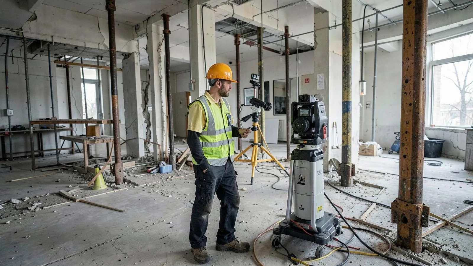
3D laser scanning directly addresses the safety and data-quality limitations of manual inspections. By using tripod-mounted terrestrial scanners or mobile mapping systems, a scanning team can document vast areas quickly and from a safe distance.
The core benefit is a dramatic reduction in "time on target"—the duration an inspector is exposed to a hazardous condition. Instead of spending hours on a lift taking dozens of hand measurements, a technician can place a scanner, retreat to a safe location, and let the instrument capture millions of data points in minutes. A typical field capture phase for a mid-sized commercial building can be completed in just 1-3 days.
This process provides engineers with objective, comprehensive data for a more thorough existing structure verification.
Data Engineers Gain for Structural Assessment
The point cloud deliverable from a building scan is far more than a 3D picture. It is a precise dataset that enables detailed quantitative analysis impossible with tape measures and string lines.
- Deflection and Deformation: The dense point cloud allows for precise analysis of beam and slab deflection. By slicing through the cloud, engineers can measure sag at any point along a member's length and compare it to design tolerances.
- Plumb, Level, and True: Columns can be analyzed for plumbness, and floors for overall flatness and levelness. This data is critical for understanding load paths, settlement, and structural stability.
- Accurate Member Geometry: The exact dimensions and orientation of structural members—beams, columns, braces—are captured. This eliminates assumptions and provides accurate inputs for structural models.
- Context for Crack Mapping: While a scanner doesn't detect cracks itself, the high-resolution panoramic imagery integrated with the point cloud provides a detailed visual record. This allows engineers to map and monitor visible cracks within their precise 3D context.
These analyses are often performed directly on the point cloud or a subsequent structural Scan-to-BIM model. This data-driven approach removes guesswork and allows for a more confident and accurate structural assessment.
The Structural Scanning and Analysis Workflow
The process of using building scanning for safer inspections follows a clear, repeatable workflow from site capture to engineering analysis.
- Scoping & Planning: The project team defines the required level of detail (LOD) and the specific areas of concern. The scanning provider develops a capture plan to ensure full coverage while prioritizing safety.
- Field Capture: A 1- or 2-person team arrives on-site with terrestrial laser scanners and/or mobile mapping devices. They systematically capture data from multiple positions to ensure complete coverage and minimize data shadows. This phase typically takes 1-3 days.
- Point Cloud Registration: Back in the office, the individual scans are aligned and merged into a single, cohesive point cloud. This registration process is critical, as registration errors can affect deformation scans and lead to false conclusions. The final registered point cloud has a typical accuracy of ±5 mm.
- Data Analysis & Modeling: The registered point cloud is delivered to the engineering team. They can use software like Trimble RealWorks to perform deflection and plumbness analysis directly. Alternatively, the point cloud is used as a reference to build an accurate as-built Revit model for further design and coordination.
This workflow separates the hazardous task of data collection from the intellectual task of analysis, allowing engineers to focus on their core expertise in a safe office environment. It also reduces the need for multiple return visits to the site, as discussed in how architects use 3D scanning to eliminate field visits.
Limitations: What Building Scanning Does Not Replace
While incredibly powerful, building scanning is a tool for capturing surface geometry. It is not a replacement for all aspects of a traditional structural inspection. Understanding its limitations is key to using it effectively.
- No Material Analysis: Laser scanning cannot determine a material's strength, composition, or condition (e.g., concrete PSI, steel corrosion rate). Core sampling, coupon testing, and other material science techniques are still required.
- No Subsurface Detection: Scanners cannot see through solid objects. They cannot detect rebar within concrete, conditions inside a wall cavity, or subsurface soil conditions. Ground-penetrating radar (GPR) and destructive investigation are still necessary for these tasks.
- Dependent on Line of Sight: Scanners only capture what they can see. Areas hidden behind permanent equipment, inside wall cavities, or above solid drop ceilings will not be captured without demolition or specialized access.
Building scanning should be viewed as a powerful complement to traditional methods. It provides the precise geometric "what and where" that allows engineers to more intelligently target their physical inspections and material testing. The process is foundational to any building scanning for structural analysis project.
Next step
Building scanning provides an unparalleled level of detail for existing conditions, enabling safer, more accurate, and more efficient structural assessments for renovation projects. By minimizing on-site risk and providing comprehensive data, it empowers engineers to make better design decisions.
If your team is planning a renovation and needs reliable as-built documentation for structural analysis, contact ZEALOT Reality Capture. The team provides quotes in 24 hours.