TL;DR
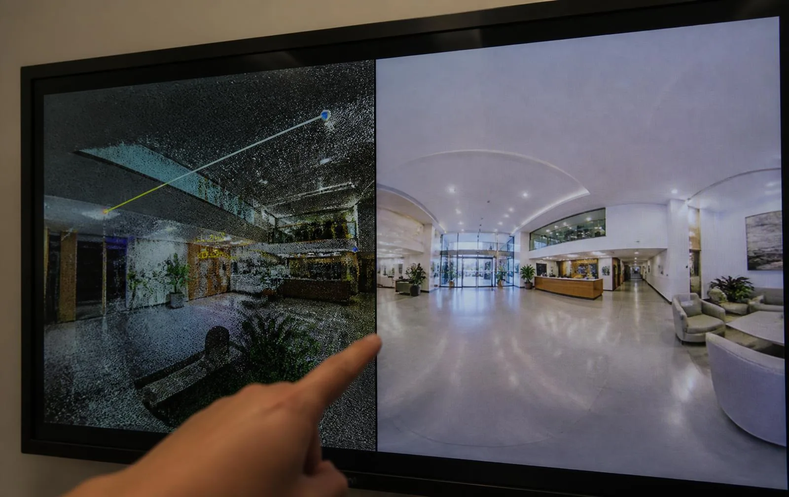
A digital twin and a virtual tour are built from the exact same site visit — a single LiDAR scanning session capturing a ±5mm registered point cloud with panoramic imagery every 2–3 meters. The difference is what happens with that data afterward. A virtual tour *is* the click-through walk. A digital twin is the full measurable environment underneath it — the same tour, plus the point cloud itself, plus an optional Revit model, built to be worked from over the life of the building rather than viewed once.
A digital twin and a virtual tour are built from the exact same site visit — a single LiDAR scanning session capturing a ±5mm registered point cloud with panoramic imagery every 2–3 meters. The difference is what happens with that data afterward. A virtual tour *is* the click-through walk. A digital twin is the full measurable environment underneath it — the same tour, plus the point cloud itself, plus an optional Revit model, built to be worked from over the life of the building rather than viewed once.
What do they actually share?
| Shared foundation | Detail |
|---|---|
| Capture method | Single scanning session, mobile LiDAR + panoramic camera |
| Panorama spacing | Every 2–3 meters of walked path |
| Underlying accuracy | ±5mm registered point cloud |
| Field pace | 80,000–120,000 sq ft per field day |
Neither one requires a separate site visit from the other. If your project is scoped as one, upgrading to the other later is a delivery decision, not a recapture.
So what's actually different?
A virtual tour is the walk-through itself: click through panoramic positions in a browser, look around, take basic measurements against the anchored geometry. It's built for people who need to *see* the space — leasing, marketing, remote stakeholders, briefing subs before mobilization.
A digital twin includes everything a tour does, plus full access to the point cloud underneath it and, optionally, a Revit model layered on top. It's built for people who need to *work from* the building over time — facility managers who need dimensions on demand, teams planning phased renovations, capital project groups tracking a portfolio.
A side-by-side
| Virtual Tour | Digital Twin | |
|---|---|---|
| Primary output | Click-through panoramic walk-through | Full measurable environment: point cloud + panoramas + optional BIM |
| Typical buyer | Brokers, marketing, remote stakeholders | Facility managers, owners, capital planning teams |
| Can you measure in it? | Yes, basic dimensions | Yes, full point cloud access for any measurement |
| Does it update over time? | Static record of the capture date | Can be rescanned/refreshed as the building changes |
| Software needed | None — browser only | None for the twin itself; Revit only if the BIM layer is used |
Real projects, same underlying capture
A 180,000 sq ft downtown block of six connected historic buildings was captured with 2,000+ linked panoramas — delivered as a tour that replaced 14 planned site visits by the architect and MEP team, saving roughly $18,000 in travel and time. That's a virtual tour doing exactly the job it's built for: keeping people out of a building they don't need to physically visit.
A 12-building, 480,000 sq ft university campus was captured across 9 field days and delivered as a federated digital twin — point clouds, panoramas, and per-building LOD 200 models all on one coordinate system. That dataset replaced scattered PDFs across the facilities team, flagged 19 non-compliant ADA ramps, and cut an estimated $85,000 in repeat field-verification trips. That's a digital twin doing its job: a working dataset a facilities team returns to again and again, not a one-time walkthrough.
Which one do you actually need?
Ask what happens after someone opens it. If the answer is "they look around and leave" — leasing a space, marketing a listing, giving a remote stakeholder a sense of the building — a virtual tour is enough, and it's the more economical choice. If the answer is "they measure something, plan against it, or come back to it repeatedly over months or years" — facility management, phased renovation, capital planning — the full dataset behind a digital twin is what actually earns its cost.
Does either one stay useful after the initial delivery, or is it a one-time snapshot?
This is where the two genuinely diverge, beyond just what's included at delivery. A virtual tour is inherently a dated record — it shows the building exactly as it was on the capture date, which is precisely its value for leasing, insurance, and condition documentation, but it isn't meant to be kept current. A digital twin is built to be updatable: because it's the full measurable point cloud rather than just a fixed set of panoramic views, it can be rescanned and refreshed as the building changes, and the refreshed data slots into the same environment your team already knows how to use. If your project will change meaningfully over its life — a phased renovation, a facility under continuous capital improvement — that update path is worth weighing alongside the up-front deliverable list.
What does each one cost in field time, and does scope change that?
Almost nothing, because the field time is identical — both are captured in the same single visit at 80,000–120,000 sq ft per field day, using the same mobile LiDAR and panoramic camera. The cost difference between a tour and a twin lives almost entirely in what happens after the crew leaves the site: whether the deliverable includes full point cloud access, whether a Revit model gets layered on top, and how the hosting or access is scoped. That's worth knowing before a budget conversation, because "we need a tour" and "we need a twin" aren't different field days — they're different decisions about what to build from the same data.
Because both come from the same capture session, there's no wrong choice that costs you a second site visit. See our full explainer on what a digital twin actually is, or the virtual tours service page and digital twin service page for the complete deliverable lists.